Laser scans: Unmatched accuracy for mission-critical builds
share


TL;DR On mission-critical projects, even small installation errors can cause delays and rework. By combining Buildots’ existing progress and risk insights with highly accurate laser scans, teams can identify spatial conflicts and spot clashes – all in one platform.
Mission-critical construction projects like data centers, hospitals and semiconductor fabs are high-stakes and complex. Ensuring precise installation is vital – even minor misalignments can lead to costly rework and project delays.
Buildots already helps clients solve these problems, saving Intel and others millions in rework costs and weeks of delays. But sometimes, mission-critical projects require an additional layer of precision. This is where laser scans (also known as LiDAR) come in.
Why add laser scans to your construction intelligence tech stack?
Buildots offers mission-critical construction teams clear visual documentation, precise progress data (down to the individual element) and predictive insights into delay risks.
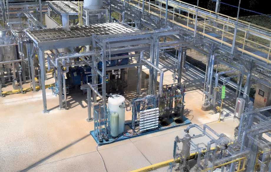
Laser scans add another layer to the depth and sophistication of this data by capturing site conditions accurately down to the millimeter or fraction of an inch. This helps ensure construction aligns with design intent, making laser scanning ideal for detecting errors and validating installations. By integrating the two, we create the best of both worlds.
But why is having both sets of capabilities in one platform so important?
Firstly, disconnected tools create inefficiencies. Juggling multiple platforms for laser scanning and progress tracking forces teams to manually align data, increasing the risk of inconsistencies, delays, and missed insights.
Secondly – and crucially – data without action is just noise. Capturing site conditions with high accuracy is only valuable if teams can act on it efficiently. Used alone, laser scanning platforms don’t necessarily give teams the tools they need to develop mitigation plans and ensure those plans are put into action.
Real-world use cases
Laser scans are crucial in verifying spatial constraints for operations and maintenance teams. When installing large industrial equipment, teams can compare the scans to BIM models to ensure everything fits the required clearances. This same process proves invaluable when maneuvering essential machinery like scissor lifts through tight corridors. By identifying spatial conflicts before installation, teams can avoid delays and keep equipment logistics running smoothly.
Another benefit lies in clash detection. Laser scans capture site conditions with unmatched precision, allowing project teams to overlay LiDAR point clouds onto BIM models and uncover both hard and soft clashes early. These might include misaligned structural elements or MEP systems interfering with planned installations. Catching discrepancies at this stage helps prevent costly rework, keeping the project on schedule and within budget. This approach has already saved Intel 4.3% in rework costs – amounting to millions of dollars – on its global semiconductor fab construction program.
How do laser scans fit into the Buildots platform?
Laser scans are displayed in a dedicated interface within Buildots, providing seamless access to detailed measurements and linking directly to other platform insights.
To get started, teams simply use any E57-format laser scanner to capture their site independently, before uploading the file to Buildots. The point cloud viewer is delivered through the seamlessly embedded NavVis IVION software.
Laser scanning and AI tracking are better together – especially on mission-critical projects where precision and confidence matter most.
Want to see the new capability in action? Book a demo.
Related reading

Construction workflows that work: Progress reporting and risk management between owners and contractors
From drones to data: How we’re transforming underground utility tracking
How is AI solving the labor shortage in mission critical construction?